Visualisation
For civil engineering and architecture
NOTE: Due to the sensitive nature of some projects, where appropriate I have substituted example of my own work where the technical skills are comparable and only the content is different.


Technical Skills
Developing interactive applications including VR/AR experience in Unity game engines for ;
Gamification of content
Design review (Clash detection, User experience testing)
Human factors testing
Community and Stakeholder engagement
PR and Entertainment
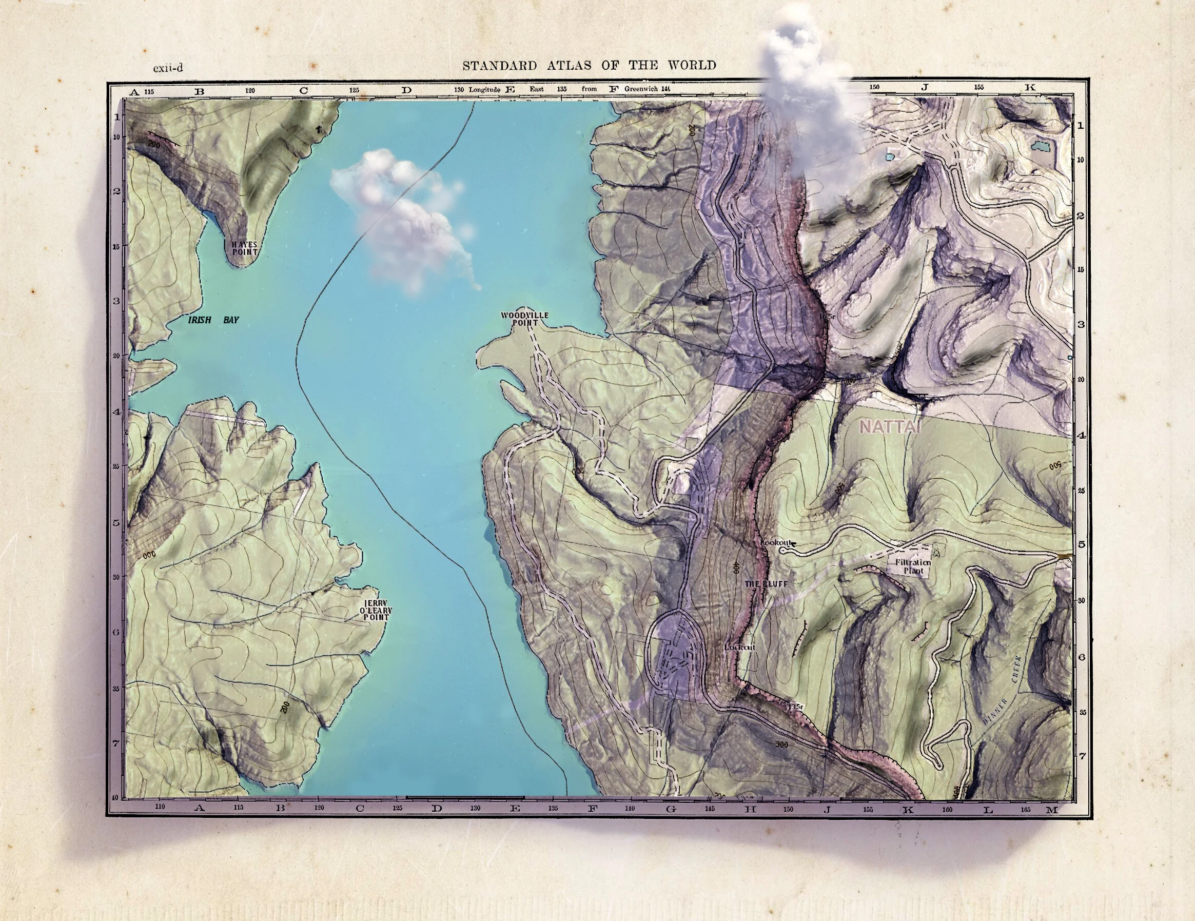
Integration of engineering datasets such as CAD, BIM and GIS Map formats into visualisations including;
Geo Located visualisation with
Sub meter visualisation positioning
combining multiple datasets;
Point clouds
Laser and Lidar scans
Photogrammetry
Photo and video matching
Terrain Data (Tin)
Location accurate lighting, seasons and weather
Working knowledge of CAD, BIM and GIS software suites including Navisworks, Infraworks and Bentley Context Capture.
Excellent knowledge of 3Ds max, Adobe Suite, rendering tools and other industry tools.
Photogrammetry capturing and Photography
Motion graphics, animation, rendered stills, and videography
4D time lapse
Proposed road and rail aerial alignment flyover
Community impact and 4D timelapse
Showcases such as building, tunnel or site fly-through
Photosimluations of sites using geo-referenced 3D models into photography
Illustration and marketing material
Content management in CDE’s
Soft Skills
Managing internal and external client relationships
Project delivery on time and on budget
Strong presentation and communication skills
Creative problem solver
Leadership experience
Production experience
Real-time and Interactive Simulations
This is a test project I created in Unity’s High Definition Render Pipeline to demonstrate the power and visual fidelity that can be achieve in real-time for a fraction of the cost and time of a traditional render farm animation. Not to mention this can be rendered out as a HD animation for no extra cost faster than a render-farm and the real time scene is reusable for other projects with a simple content swap saving money on future projects.
A project using Unity’s new High Definition Render Pipeline to create both real-time and rendered content from the same asset with not drop in visual quality.
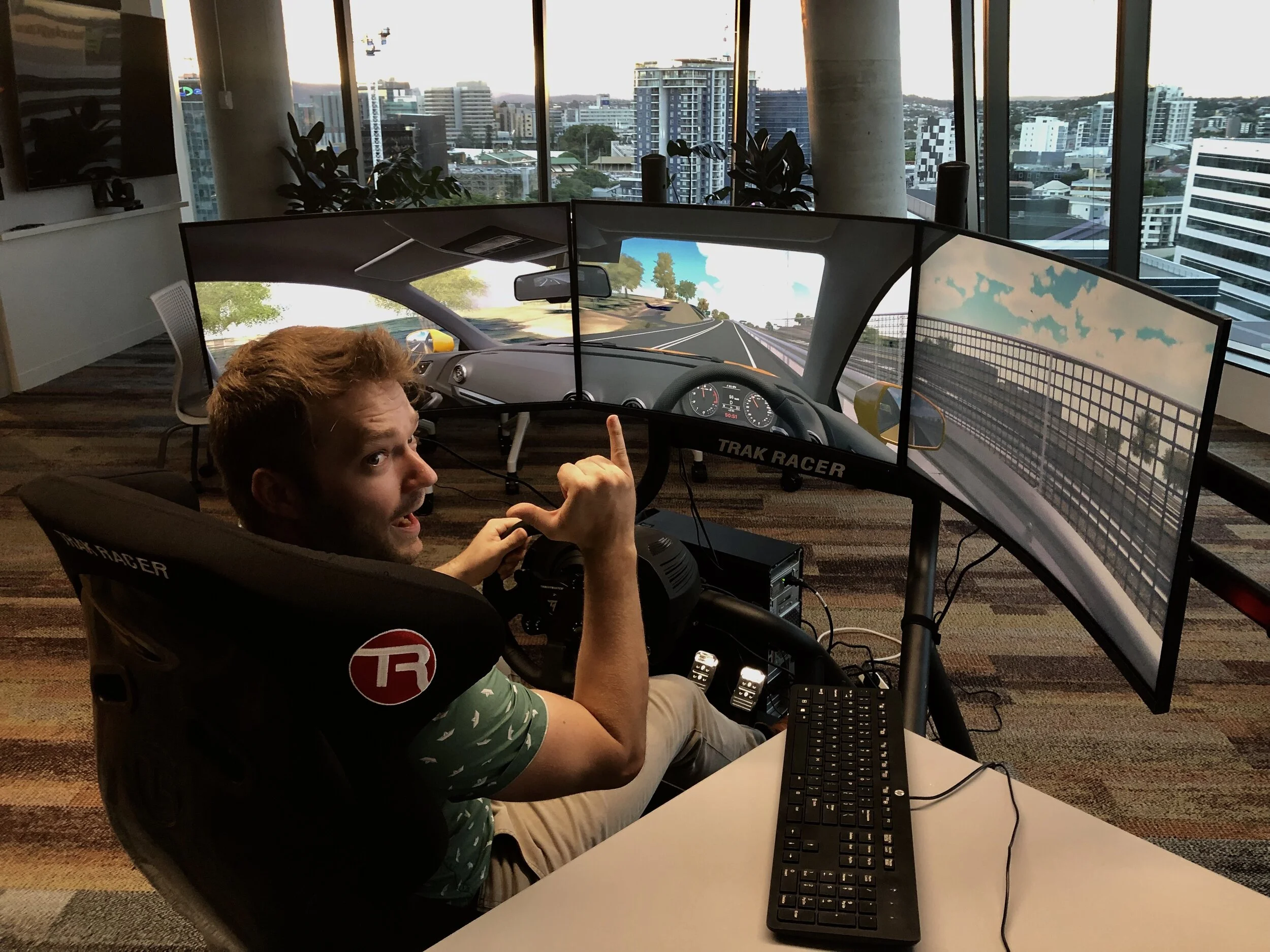
Me testing our driving simulator. We incorporated engineering datasets like CAD roadway from our engineering design team then we geo-located it into current terrain data to accurately reconstruct the current highway with the proposed upgrade for comparative testing. We worked with a human factors psychologist to evaluate the data we collected from participation. We also had the option to run this in VR mode however found this multi-screen setup more comfortable to certain age groups.
This was a interactive highway simulation used to test Human Factors and User Experience as part of extensive design review to optimise gantry placement and reduce overall cost. This inexpensive digital solution led to improvements and savings of over $1 million to the project.
Virtual Reality
This is a VR experience planned, executed and presented to the client which received a great response. It demonstrates the power of VR to engage with designers and the end users while conducting design reviews. This was both a review and feedback opportunity as the staff who would be operating the plant got to offer their feedback directly to the design engineers while learning the layout of their future worksite.
3D modelling
If you want to see my complete 3D Modelling portfolio including game assets you can click the here.
Level of detail for 3D modelling, texturing and rendering quality (Click to enlarge)

More props I created for the above vehicle
Lexus is200 I modelled from photo references
The example below is a highly optimised (Mobile ready) building based on and existing building from Google maps. It is designed to use minimal texture memory and draw calls as possible with a mobile friendly shader (No PBR). The building was modelled in 3Ds max.
The original building for comparison.
The total texture memory comes under 2048x2048px when Specular and AO are channel packed together. Click to enlarge image
below are more examples of my 3D modelling
Photogrammetry
Below are examples of my work in the Engineering space including some Photogrammetry
Photogrammetry of my bike
Level of detail captured
Car modelling from photogrammetry (Still a work in progress)
Animations
Below are examples of my storyboarding, animation, color theory, camera placement, editing , modelling, rendering and motion graphics ability. Due to the sensitive nature of my previous visualisations I have provided examples that demonstrate the same technical skills used with different content.
Communications media
The variety that visualisation allows are below with examples of promotion graphics I created for WSP’s stakeholder engagement team for a communications collaboration with a government department.
This was a stylized comms piece for a proposed rail alignment

This animation was used to communicate three proposed options for a new rail crossing to the community focusing on the overall design. The friendly cartoon style was deliberately used to avoid confusion about the rail alignments exact interaction with property boundaries that might be unintentionally inferred with a geographically accurate terrain map commonly used in visualisation as the designs were only in community consultation phase.
A closer look. This was an effective and fast style to produce
A communication piece for stakeholder engagement in Photoshop and Illustrator
An accompanying promotional illustration
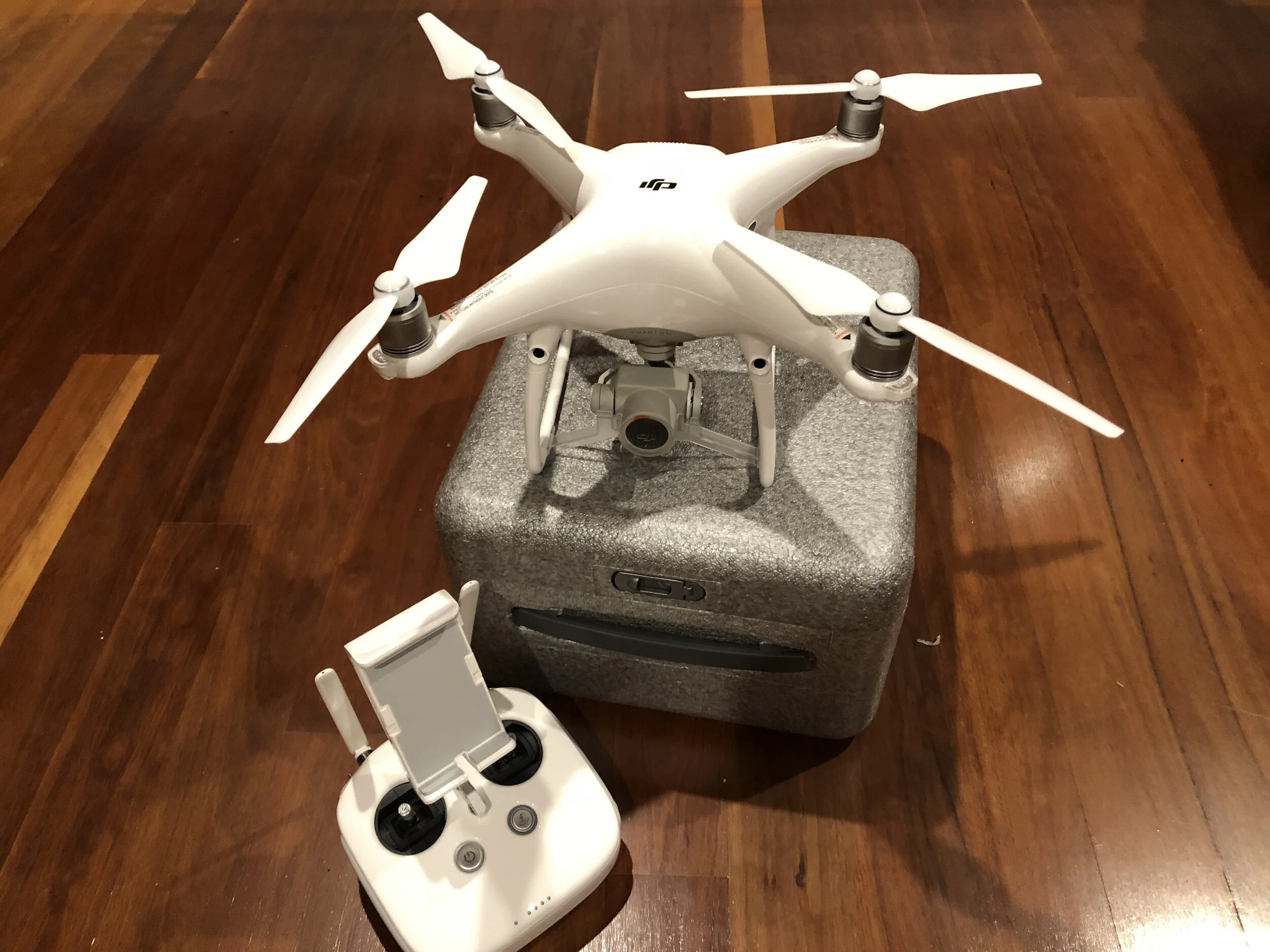
Remote Capabilities
I am set up to be able to cove a wide range of visualisation requirements using Drone, Photography, Videography with a remote work station equipped with current gen VR headsets and production software. Ideal for working remotely or at home during the Covid Pandemic.